


NOAA has installed a Physical Oceanographic Real-Time System (PORTS®) in Boston Harbor. The system includes observational equipment at MassPort’s Conley Terminal and on the Tobin Memorial Bridge…
February 17, 2026
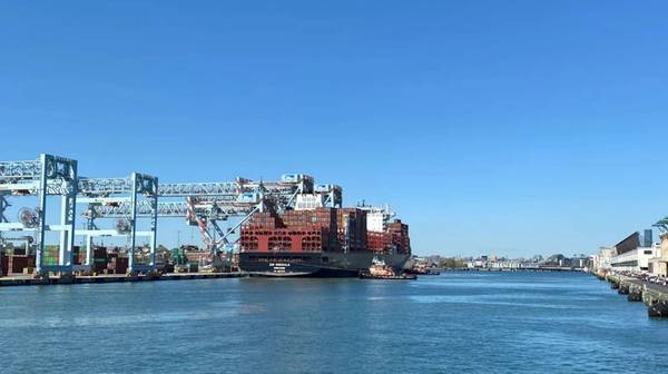
NOAA has installed a Physical Oceanographic Real-Time System (PORTS®) in Boston Harbor. The system includes observational equipment at MassPort’s Conley Terminal and on the Tobin Memorial Bridge.
The Boston Harbor PORTS, established in partnership with the Massachusetts Department of Environmental Protection, is the 41st installation in a broad, public-private partnership program, providing commercial and other vessel operators with accurate and reliable real-time information about environmental conditions to support safe navigation.
The Boston Harbor PORTS will consist of one current meter and one meteorological station that will collect wind, air temperature and barometric pressure data. The new PORTS is also slated to include the installation of a new air gap sensor at the Tobin Memorial Bridge over the Mystic River.
The sensor will provide real-time data on the amount of bridge clearance that is available to ships in an area where the tides can shift dramatically throughout the day. NOAA’s existing National Water Level Observation Network station at Boston Harbor will also be included in this newly established PORTS.
Growing ship size and
Content Original Link:
" target="_blank">


